
Make use of the pictorial maps to reach the I`tikaf City. Obtained through satellites, they would help you locate the whereabouts of the place.
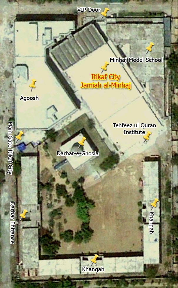
First Map : Details of I`tikaf City
This map allows you to learn about the buildings within I`tikaf City. Here Jami`-ul-Minhaj, Minhaj-ul-Quran Model School, Tahfeez-ul-Quran Institute and buildings adjacent to Darbar Ghousiyah turn into I`tikaf City in the last ten days of Ramadan.
Second Map : Nearby Details
This map will help to find out bus & wagon stops nearer by the I`tikaf City that are Sadiq Chowk, Hamdard Chowk and Minhaj University Stop.
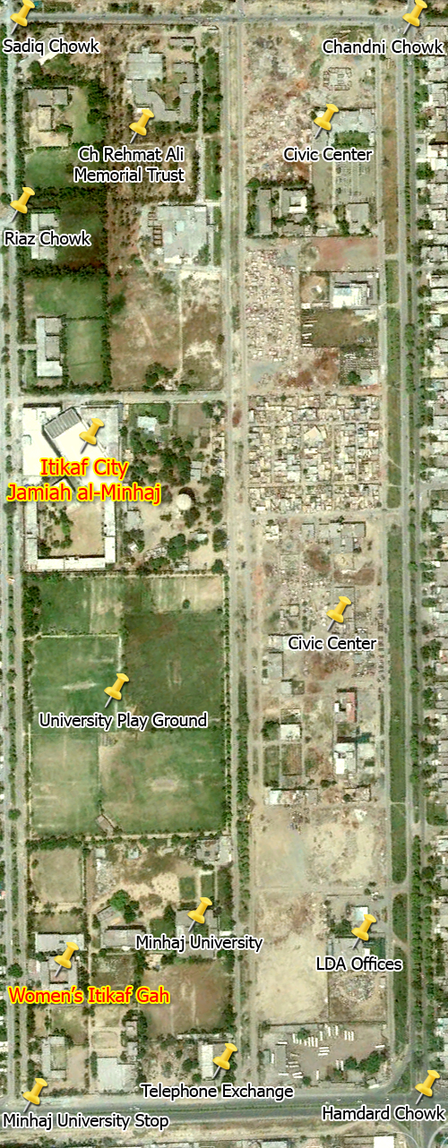
Third Map : Nearby Routs to the I`tikaf City
This map will help to find out bus & wagon stops nearer by the I`tikaf City that are Sadiq Chowk, Hamdard Chowk and Minhaj University Stop.
Comments